We did Inquiry about Mt Agung. He is the infomation we got from researching about Mt Agung and what it looks like.
Facts about Mt Agung.
Where is Mount Agung located?
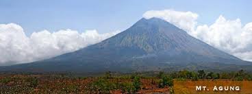
Mount Agung or Gunung Agung is located in Bali, Indonesia
When did Mount Agung last erupt ?
Mount Agung last erupted in 1963 and is still active
How many people died in the eruption?
1,584 people died during the eruption
What is the elevation on Mt Agung?
Mt Agung’s elevation is 3,031m(9,944)
What is stratovolcano made of?
A stratovolcano, also known as a composite volcano, a conical volcano made up out of alot of volcanoes like pumice, harden lava and ashes.
What are volcanic bombs?
Volcano bombs are types of rocks that come out of volcanoes and when it comes out of a volcano it forms into a twisted shape.
More information on Mt Agung
Mt Agung is a stratovolcano and is the highest point on the island. Mount Agung used to be an active volcano that erupted twice in 35 years. There was no warning signs that the volcano was going to erupt, residents then noticed that smoke was coming out of Mt Agung. Soon lava bombs started to shoot out causing damage to the land and the people.
On February 18, 1963 the residents around Mount Agung heard a loud noise and saw clouds coming out of the crater of Mt Agung. On February 24, lava began to flow out of the sides of Mount Agung and on March 17, the volcano erupted damaging the land and killing some people.
During the horrible eruption 820 people were killed by pyroclastic flows (a fast moving hot gas flow) and 163 were struck by volcano bombs and` were killed by ash falls . 165 people were killed by Lahars(a type of mud flow), 59 people were injured by pyroclastic flow. 210 people were also struck by lava fragments and died. 36 people were injured by lahars so they survived the terrifying eruption and lava flows. 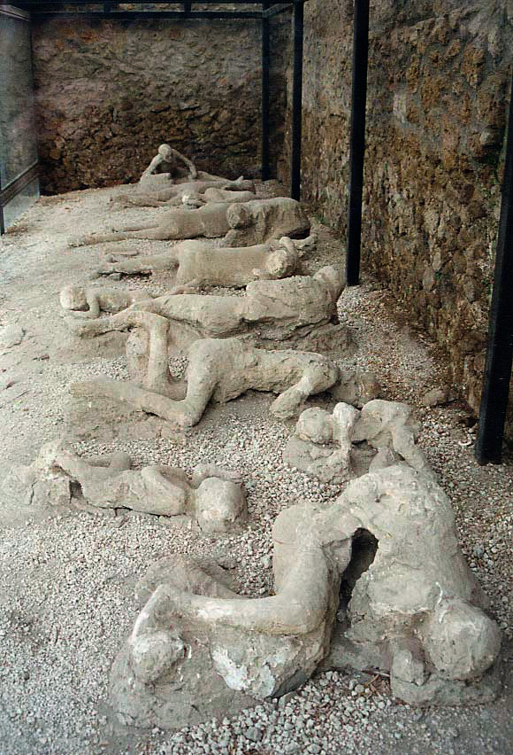
1 comment:
Hi Robin good photo of Mt Agung.
Post a Comment
Note: only a member of this blog may post a comment.